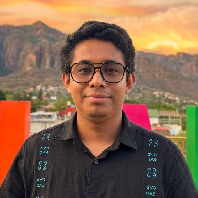
Software Developer
Brandon Marias
Full-stack developer based in Mexico. I build software that holds up outside the demo — apps that work with no signal, compliance tooling for Mexican labor law, and geographic systems fed by satellite data.
Work Experience
Where I've worked, and what I actually changed there.
Quality Analyst
Nissan Mexicana
I led the capture and analysis of vehicle quality data, transforming how results were presented. I automated the generation of charts and reports, which enabled real-time quality monitoring for the plant. This initiative not only saved significant time but also provided superior data for strategic decisions, driving continuous improvement.
Software Development Intern
Forza Global Solutions
I developed a web-based platform to manage production projects, allowing us to track each project through its different stages. I set clear time goals for each part of the project, and every responsible team recorded their progress. This led to much better control over our processes. It also helped us find and address critical issues early, which improved our overall production efficiency.
Projects
Products I designed, built, and shipped — each one live.
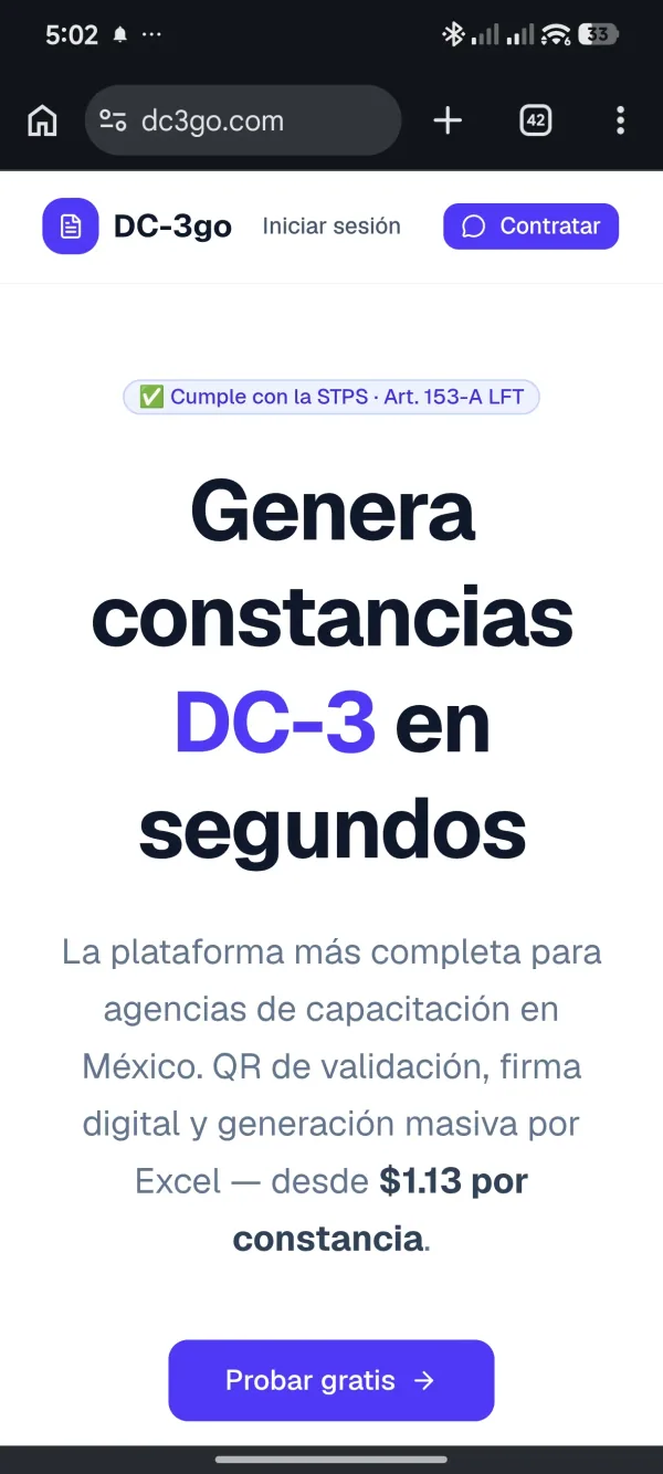

DC3GO
A platform for generating DC-3 training constancias (compliance certificates required by Mexican labor law) without the hassle. Built to streamline the full workflow: from employee and course management to certificate generation and digital signing.
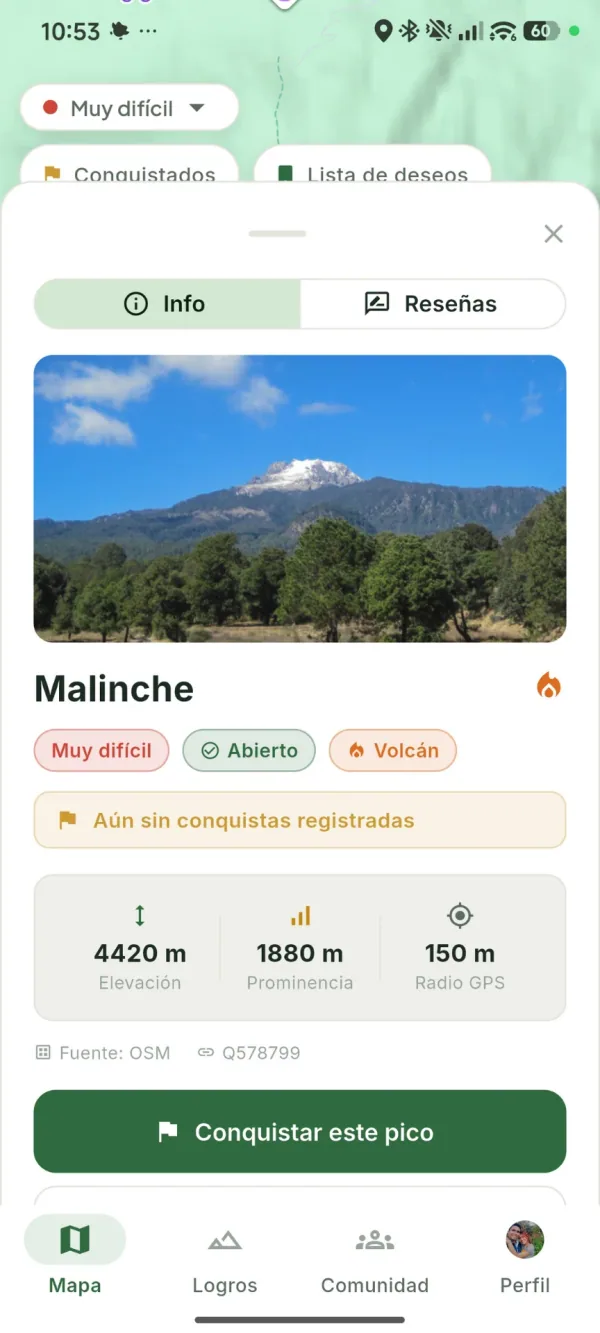
Elevate
A mountaineering app for Mexico — discover peaks, log your summits with GPS-verified conquests, leave reviews and photos, follow other climbers, suggest new peaks, and save your favorites. Built for the community that lives the mountain.
SIGAEM
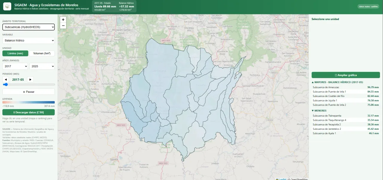
A proof-of-concept geographic information system for water and ecosystems in Morelos, Mexico. Integrates real satellite data (CHIRPS precipitation, MODIS evapotranspiration and NDVI) with official boundaries from INEGI, CONAGUA, HydroSHEDS/SRTM, and RESOLVE 2017 to produce hydrological indices — water balance, vegetation index, and more — broken down by municipality, watershed, sub-watershed, water forest, and ecoregion. Includes QGIS integration and a public web viewer.

Providencia
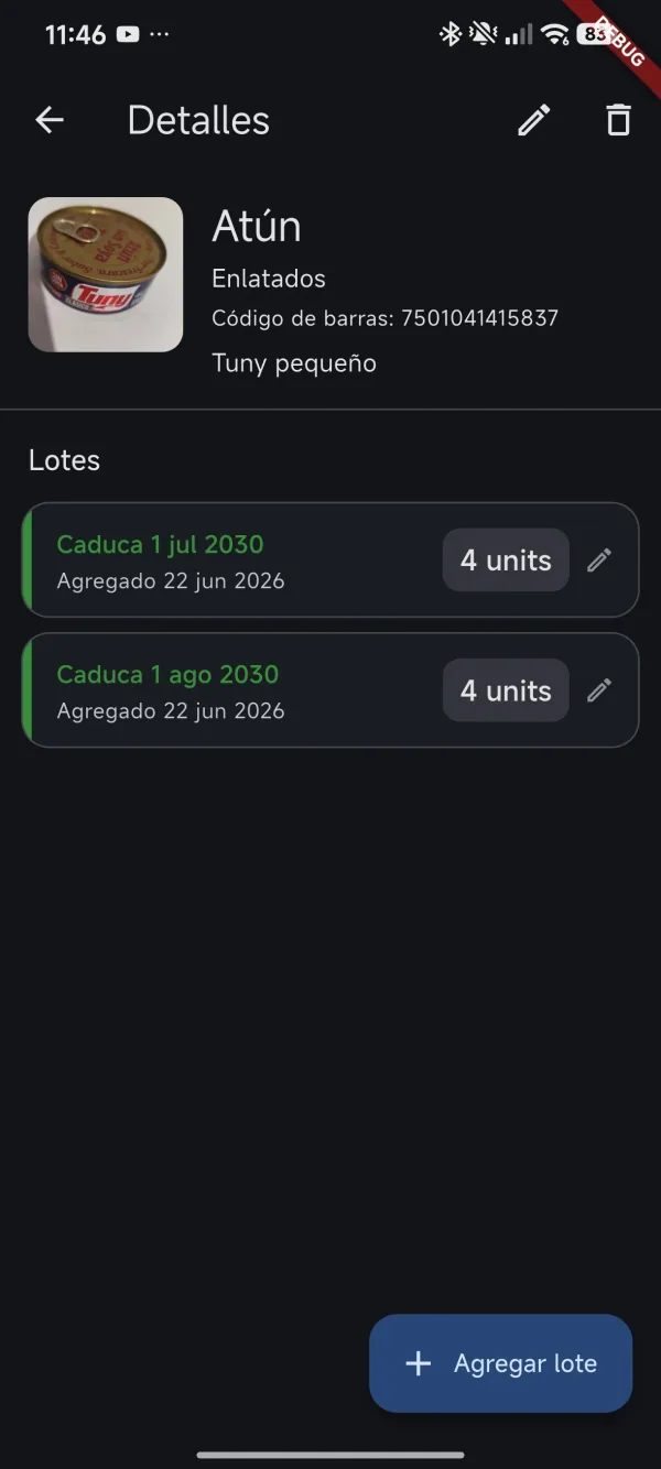
An offline-first Flutter app for LDS (Latter-day Saint) families to manage their personal home storage. Track product expiration dates, monitor inventory levels, and organize emergency preparedness kits — all without requiring an internet connection.
Education
Computer systems engineering, plus coursework still in progress.

B.S. in Computer Systems Engineering
UVEG · Universidad Virtual del Estado de Guanajuato
Comprehensive training in software architecture, databases, networking, and object-oriented programming.

BYU Pathway Worldwide
BYU Pathway · Brigham Young University – Idaho Pathway
Online academic program combining university-level courses with practical skills development in technology and communications.
Let's build something
Open to full-time roles and freelance work. If you have a project in mind — or just want to talk shop — my inbox is open.